Maps
Video: Imperial History of the Middle East (2’24”)
40 maps that explain the Middle East by Max Fisher, Vox, March 26, 2015
Maps of Israel compiled by Jacob Richman, JR Links
Excellent maps by Shaul Arieli
Maps of Israeli territorial proposals in 2000 (Taba) and 2008 (Olmert proposal), in Palestinians Rejected Statehood 3 Times, Claim Frustration — with Israel by Alex Safian, Committee for Accuracy in Middle East Reporting in America, September 22, 2011
1967 Six Day War Maps by HonestReporting
Palestine: Land ownership by sub-district (1945), United Nations Information System on the Question of Palestine (UNISPAL), August 1, 1950
‘Historic Palestine’ – A Misleading Anachronism, HonestReporting.com, December 18, 2019
1916 The Ottoman Empire and Palestine: The Independent Sanjak of Jerusalem, Sanjak of Balqa (Nablus), Sanjak of Acre, Vilayet of Syria
Ottoman and Arab Maps of Palestine, 1880s-1910s by Zachary J. Foster, The Afternoon Map, July 30, 2013
1792 Map of the Near East by Robert de Vaugondy, indicating Canaan
A Map Of Palestine From 1759 by Deebo, IsraellyCool.com, November 14, 2015
14th Century Near East by Alexikoua
9th Century southern Levant (includes kingdoms of Judah, Israel, Edom, Moab, Ammon, and Aram-Damascus)
Biblical Canaan, late 2nd Millennium BCE
Israel in Maps, Israel Ministry of Foreign Affairs
3D Topographic Map of Israel by Meir Kahane, Ofra Field School (3’01” Virtual Israel Touring video by Rabbi Aryeh A. Leifert, February 22, 2015)
The Mendacious Maps of Palestinian “Loss” by Shany Mor, The Tower, Issue 22, January 2015 (see also Countering the ‘shrinking Palestine Maps’ scam by Edgar Davidson, June 2, 2014)
Freedom in the World, Freedom House
Lands of Contention: Overview of Israeli settlements and proposed land swaps, The New York Times, February 13, 2011 [related article by Bernard Avishai here]
Imagining the Israeli-Palestinian Border: Interactive map depicting various land-swap options, Washington Institute for Near East Policy, January 2011 [corresponding report here]
Regional and historical maps, including a set of 41 interactive maps covering 5000+ years of history, from ProCon.org.
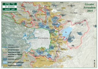
Jerusalem Maps, Ir Amim
Perry-Castañeda Library Map Collection, University of Texas at Austin: Middle East, Israel
The Arab Israel Conflict in Maps, the Jewish Agency for Israel

